14 Feb Land Dimensions provides a Revit model from a 3D Laser Scan
Posted at 02:43h
in News
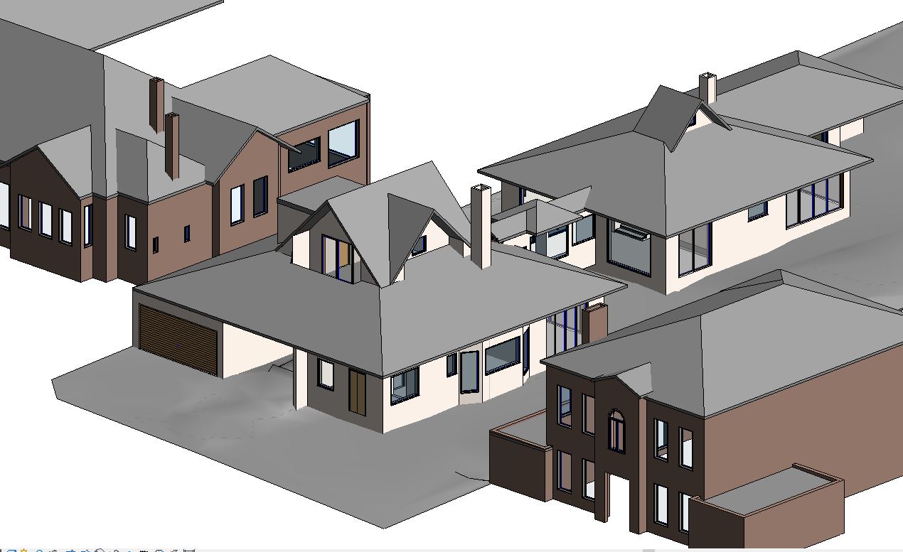
A 3d laser scan was performed on a detailed and complex residential dwelling. The laser scan produced a point cloud which is a dataset containing millions of points with accurate 3 dimensional coordinates. The point cloud was then transformed into a 3D revit model for our client.